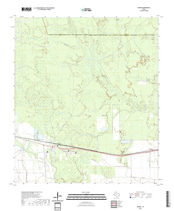
2022 Map of Devers
USGS Topo · Published 2022About this map
Devers and the neighboring settlement of Felicia anchor this portion of the Texas coastal plain, where the landscape is defined by a dense network of slow-moving waterways and prairie. The intricate drainage patterns of Batiste Cr, Bull Tongue Cr, and Willow Cr suggest a terrain prone to seasonal shifts in water levels, typical of the region's low-lying ecology. Open stretches like Stockpen Prairie and Willow Cove punctuate the wooded areas, indicating the historic ranching and agricultural use of the land.
Find a feature on this map
32 named features on this map. Tap any name to fly to it.
Don’t see what you’re looking for? This feature index may not catch every label — zoom into the map to look around manually.
Map Details
Editions of this 2022 Devers Map
This is the sole edition of this map. No revisions or reprints were ever made.
Other maps of this area

1943 · Whites Bayou
USGS Topo · 1:24,000

1943 · Liberty
USGS Topo · 1:125,000

1945 · Nolte
USGS Topo · 1:31,680

1950 · Houston
USGS Topo · 1:250,000

1954 · Beaumont
USGS Topo · 1:250,000

1955 · Daisetta
USGS Topo · 1:62,500

1955 · Sour Lake
USGS Topo · 1:62,500

1956 · Houston
USGS Topo · 1:250,000

1957 · Beaumont
USGS Topo · 1:250,000

1961 · Shiloh
USGS Topo · 1:24,000