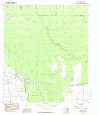
1984 Map of Devers
USGS Topo · Published 1985About this map
Devers and the neighboring settlement of Felicia stand at the heart of this southeast Texas landscape during the late 1970s and early 1980s. The region is defined by a dense network of watercourses and low-lying drainage features typical of Liberty County, including the winding Batiste Creek and the meandering Bull Tongue Creek. To the south of the primary settlement lies the timbered expanse of Devers Woods, while the hydrologic pattern is further complicated by numerous sloughs and gullies such as Jerome Slough and Neds Gully.
Find a feature on this map
17 named features on this map. Tap any name to fly to it.
Don’t see what you’re looking for? This feature index may not catch every label — zoom into the map to look around manually.
Map Details
Editions of this 1984 Devers Map
This is the sole edition of this map. No revisions or reprints were ever made.
Other maps of this area

1943 · Whites Bayou
USGS Topo · 1:24,000

1943 · Liberty
USGS Topo · 1:125,000

1945 · Nolte
USGS Topo · 1:31,680

1950 · Houston
USGS Topo · 1:250,000

1954 · Beaumont
USGS Topo · 1:250,000

1955 · Daisetta
USGS Topo · 1:62,500

1955 · Sour Lake
USGS Topo · 1:62,500

1956 · Houston
USGS Topo · 1:250,000

1957 · Beaumont
USGS Topo · 1:250,000

1961 · Shiloh
USGS Topo · 1:24,000