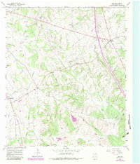
1965 Map of Dew
USGS Topo · Published 1983About this map
Avant Prairie and the rolling creek bottoms of eastern Texas define this landscape as it was documented in the mid-1960s with updates from 1982. The small community of Dew serves as a local hub near the eastern edge, while the Burlington Northern railroad cuts through the western portion of the map near the settlement of Freestone. For genealogists, the map is particularly rich in family-named landmarks and burial sites, including the Kendrick Cem, Salem Cem, and Philpott Cem. The terrain is deeply etched by a complex drainage network featuring Keechi Creek, Linn Creek, and numerous smaller branches like Graveyard Branch and Bob Spring Branch. This 1:24,000 scale survey illustrates a rural economy transitioning from traditional farming toward energy infrastructure, evidenced by several Gas Wells and pipelines crossing the countryside.
Find a feature on this map
45 named features on this map. Tap any name to fly to it.
Don’t see what you’re looking for? This feature index may not catch every label — zoom into the map to look around manually.
Map Details
Editions of this 1965 Dew Map
2 editions found
Other maps of this area

1919 · Fairfield
USGS Topo · 1:62,500

1920 · Mexia
USGS Topo · 1:62,500

1954 · Waco
USGS Topo · 1:250,000

1955 · Waco
USGS Topo · 1:250,000

1956 · Jewett
USGS Topo · 1:62,500

1963 · Teague North
USGS Topo · 1:24,000

1965 · Dew
USGS Topo · 1:24,000
1965 · Lanely
USGS Topo · 1:24,000
1965 · Buffalo
USGS Topo · 1:24,000
1965 · Fairfield
USGS Topo · 1:24,000