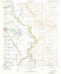
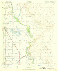
1950 Map of Dexter East
USGS Topo · Published 1984About this map
The Pecos River floodplain dominates this landscape at mid-century, where a complex network of man-made ditches and reservoirs supports agricultural life in Chaves County. Near the town of Dexter, the Dexter Federal Fish Hatchery represents a significant investment in regional conservation and industry, utilizing the area's groundwater resources. The town itself serves as a hub for the Atchison Topeka and Santa Fe railroad, which parallels the main highway and links the smaller community of Greenfield to the broader regional economy. Recreational and ranching interests are evident at Lake Van, home to the Lake Van Rod & Gun Club, and the outlying Calumet Ranch. A notable infrastructure detail is the Durand Reservoir (Abandoned) to the north, suggesting changing water management priorities as the Rio Felix flows into the Pecos at the southern edge of the survey.
Find a feature on this map
13 named features on this map. Tap any name to fly to it.
Don’t see what you’re looking for? This feature index may not catch every label — zoom into the map to look around manually.
Map Details
Editions of this 1950 Dexter East Map
3 editions found
Other maps of this area

1949 · Wade Ranch
USGS Topo · 1:24,000

1950 · Dexter West
USGS Topo · 1:24,000

1950 · Bottomless Lakes
USGS Topo · 1:24,000

1950 · South Spring
USGS Topo · 1:24,000

1950 · Dexter East
USGS Topo · 1:24,000

1951 · Ninemile Well
USGS Topo · 1:24,000

1951 · Hagerman
USGS Topo · 1:24,000

1952 · Bar C Bar Ranch
USGS Topo · 1:24,000

1952 · Hagerman SW
USGS Topo · 1:24,000

1955 · Roswell
USGS Topo · 1:250,000