
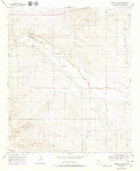
1956 Map of Diamond A Ranch
USGS Topo · Published 1957About this map
The Rio Hondo carves a winding path across this mid-century cattle-ranching landscape in Chaves County, defining a territory where water management was essential to survival. The map illustrates a network of sophisticated irrigation efforts, featuring numerous ditches and levees alongside named windmills that sustained livestock across the arid terrain. Working ranches such as the Diamond A Ranch and White Ranch serve as the primary hubs of activity, linked by private roads and trails that traverse the various draws and arroyos.
Find a feature on this map
26 named features on this map. Tap any name to fly to it.
Don’t see what you’re looking for? This feature index may not catch every label — zoom into the map to look around manually.
Map Details
Editions of this 1956 Diamond A Ranch Map
2 editions found
Other maps of this area

1949 · Hondo Reservoir
USGS Topo · 1:24,000

1949 · Juan Lake
USGS Topo · 1:24,000

1949 · Corn Ranch
USGS Topo · 1:24,000

1950 · Corn Ranch
USGS Topo · 1:24,000

1955 · Roswell
USGS Topo · 1:250,000

1958 · Roswell
USGS Topo · 1:250,000

1959 · Diamond A Ranch
USGS Topo · 1:24,000

1961 · Indian Bluff
USGS Topo · 1:62,500

1962 · Roswell
USGS Topo · 1:250,000

1962 · Horseshoe Bend
USGS Topo · 1:62,500