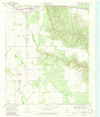
1967 Map of Dickens South
USGS Topo · Published 1981About this map
Dickens serves as the focal point for this West Texas landscape, where the flat plains of the Llano Estacado meet the erosional breaks of the Caprock. The community’s layout includes an Athletic Field and a nearby Cem, reflecting its role as a local hub. To the east, the terrain becomes increasingly complex as the Croton Breaks form a labyrinth of deep ridges and valleys carved by Croton Creek. This transition from the level agricultural land of the west to the dissected canyons of the east is the defining geographic feature of the quadrangle.
Find a feature on this map
13 named features on this map. Tap any name to fly to it.
Don’t see what you’re looking for? This feature index may not catch every label — zoom into the map to look around manually.
Map Details
Editions of this 1967 Dickens South Map
2 editions found
Other maps of this area

1954 · Lubbock
USGS Topo · 1:250,000

1959 · Gilpin
USGS Topo · 1:24,000

1967 · Dickens North
USGS Topo · 1:24,000

1967 · Dickens South
USGS Topo · 1:24,000

1967 · Spur
USGS Topo · 1:24,000

1967 · Haystack Mountain
USGS Topo · 1:24,000

1967 · Spur NW
USGS Topo · 1:24,000

1968 · East Afton
USGS Topo · 1:24,000

1968 · Foreman Chapel
USGS Topo · 1:24,000

1968 · Croton Camp
USGS Topo · 1:24,000