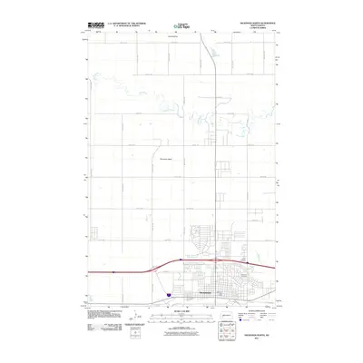
2011 Map of Dickinson North
USGS Topo · Published 2011About this map
Dickinson sits at the southern edge of this West River landscape, serving as a hub for the surrounding Stark County ranching and farming lands. The northern expansion of the city is evident as the grid of residential streets pushes toward the meandering Green River, which snakes across the northern half of the sheet. Rising above the flat plains are distinctive topographic landmarks like Camels Butte and Seventeen Butte, providing natural navigation points in an area otherwise defined by long, straight section-line roads such as 115th Ave SW. This 2011 survey captures the community's established infrastructure, including the Dickinson Post Office and local burial sites like Saint Patricks Cemetery and Dickinson Cemetery, illustrating the transition from the city's commercial core along W Broadway St to the open prairie and river valley to the north.
Find a feature on this map
31 named features on this map. Tap any name to fly to it.
Don’t see what you’re looking for? This feature index may not catch every label — zoom into the map to look around manually.
Map Details
Editions of this 2011 Dickinson North Map
This is the sole edition of this map. No revisions or reprints were ever made.
Other maps of this area

1953 · Dickinson
USGS Topo · 1:250,000

1953 · Watford City
USGS Topo · 1:250,000

1957 · Dickinson
USGS Topo · 1:250,000

1957 · Watford City
USGS Topo · 1:250,000

1959 · Dickinson North
USGS Topo · 1:24,000

1959 · Dickinson South
USGS Topo · 1:24,000

1959 · Lehigh
USGS Topo · 1:24,000

1962 · Davis Buttes
USGS Topo · 1:24,000

1967 · Watford City
USGS Topo · 1:250,000

1973 · Manning SE
USGS Topo · 1:24,000