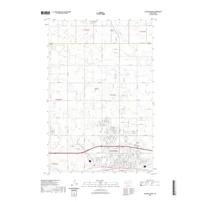
2020 Map of Dickinson North
USGS Topo · Published 2020About this map
Dickinson serves as the regional hub of Stark County, with the Stark County Courthouse anchored in the city's heart south of the BNSF Railway. The urban layout transitions from the dense street grid of the city center to sprawling northern residential expansions and technical landmarks like the Dickinson Mausoleum. Outside the city limits, the terrain shifts to the characteristic high plains of North Dakota, marked by prominent elevations such as Camels Butte and Seventeen Butte. The Green River meanders across the northern half of the region, while the southern landscape is defined by the headwaters of Duck Cr. Genealogists will find significant value in the detailed locations of Saint Patricks Cem, Saint Wenceslaus Cem, and the larger Dickinson Cem, which reflect the community's local history and heritage.
Find a feature on this map
94 named features on this map. Tap any name to fly to it.
Don’t see what you’re looking for? This feature index may not catch every label — zoom into the map to look around manually.
Map Details
Editions of this 2020 Dickinson North Map
This is the sole edition of this map. No revisions or reprints were ever made.
Other maps of this area

1953 · Dickinson
USGS Topo · 1:250,000

1953 · Watford City
USGS Topo · 1:250,000

1957 · Dickinson
USGS Topo · 1:250,000

1957 · Watford City
USGS Topo · 1:250,000

1959 · Dickinson North
USGS Topo · 1:24,000

1959 · Dickinson South
USGS Topo · 1:24,000

1959 · Lehigh
USGS Topo · 1:24,000

1962 · Davis Buttes
USGS Topo · 1:24,000

1967 · Watford City
USGS Topo · 1:250,000

1973 · Manning SE
USGS Topo · 1:24,000