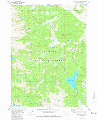
1981 Map of Dickinson Park
USGS Topo · Published 1981About this map
Shoshone National Forest defines the southern reaches of this Wyoming landscape, where the Popo Agie River carves through the terrain south of Dickinson Park. The map documents a complex network of backcountry routes, including the Bears Ears (Pack) Trail and the Shoshone (Pack) Trail, which served as the primary infrastructure for traversing this high-elevation region before the late 20th century.
Find a feature on this map
39 named features on this map. Tap any name to fly to it.
Don’t see what you’re looking for? This feature index may not catch every label — zoom into the map to look around manually.
Map Details
Editions of this 1981 Dickinson Park Map
3 editions found
Other maps of this area

1937 · Moccasin Lake
USGS Topo · 1:48,000

1943 · Moccasin Lake
USGS Topo · 1:62,500

1952 · Wind River
USGS Topo · 1:24,000

1953 · Sweetwater Gap
USGS Topo · 1:24,000

1953 · Cony Mountain
USGS Topo · 1:24,000

1953 · Mount Arter
USGS Topo · 1:24,000

1955 · Lander
USGS Topo · 1:250,000

1958 · Lander
USGS Topo · 1:250,000

1961 · Lander
USGS Topo · 1:250,000
1969 · Temple Peak
USGS Topo · 1:24,000