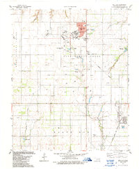
1983 Map of Dill City
USGS Topo · Published 1989About this map
Burns Flat serves as a major hub of activity in this Washita County landscape, centered around the sprawling Clinton-Sherman Airport and the adjacent U.S. Military Reservation. The town's infrastructure is well-defined, featuring the Western Oklahoma Vo-Tech Sch and Will Rogers Sch, alongside an Industrial Park that signals the era's economic focus. To the south, Dill City sits along the Atchison Topeka and Santa Fe railroad line, maintaining a traditional grid pattern in contrast to the modern layout of the airport complex.
Find a feature on this map
42 named features on this map. Tap any name to fly to it.
Don’t see what you’re looking for? This feature index may not catch every label — zoom into the map to look around manually.
Map Details
Editions of this 1983 Dill City Map
2 editions found
Other maps of this area

1955 · Clinton
USGS Topo · 1:250,000

1957 · Clinton
USGS Topo · 1:250,000

1957 · Dill City
USGS Topo · 1:62,500

1961 · Hobart
USGS Topo · 1:62,500

1961 · Retrop
USGS Topo · 1:62,500

1961 · Elk City
USGS Topo · 1:62,500

1976 · Dill City NE
USGS Topo · 1:24,000

1976 · Dill City SE
USGS Topo · 1:24,000
1983 · Foss
USGS Topo · 1:24,000

1983 · Dill City
USGS Topo · 1:24,000