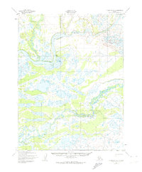
1952 Map of Dillingham A-2
USGS Topo · Published 1974About this map
Kvichak River and the Alagnak River dominate this terrain within the Dillingham quadrangle, revealing a landscape defined by an intricate network of wetlands, sloughs, and interconnected lakes. Mapped in the early 1950s using aerial photography, the sheet records a sparsely settled wilderness where human presence is marked primarily by isolated Cabins along the riverbanks. The existence of a Winter Trail in the northwest portion of the map highlights the seasonal nature of travel and transport in this part of Alaska, where frozen waterways and trails provided essential passage when summer navigation was impossible. Geodetic control points like Vabm 171 emphasize the survey's focus on precise mapping in a region where land lines were largely unsurveyed and predetermined by the Bureau of Land Management.
Find a feature on this map
9 named features on this map. Tap any name to fly to it.
Don’t see what you’re looking for? This feature index may not catch every label — zoom into the map to look around manually.
Map Details
Editions of this 1952 Dillingham A-2 Map
2 editions found
Other maps of this area

1951 · Dillingham
USGS Topo · 1:250,000

1951 · Dillingham A-1
USGS Topo · 1:63,360

1952 · Naknek
USGS Topo · 1:250,000

1952 · Dillingham A-2
USGS Topo · 1:63,360

1952 · Naknek D-2
USGS Topo · 1:63,360

1952 · Dillingham A-3
USGS Topo · 1:63,360

1952 · Naknek D-3
USGS Topo · 1:63,360

1954 · Dillingham
USGS Topo · 1:250,000
1954 · Dillingham B-2
USGS Topo · 1:63,360

1954 · Dillingham B-3
USGS Topo · 1:63,360