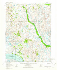
1952 Map of Dillingham A-6
USGS Topo · Published 1963About this map
Nushagak River dominates the southwestern portion of this Alaskan coastal region, flowing through a landscape defined by extensive tidal flats and complex interior waterways. In the early 1950s, this area remained largely inaccessible except by water or primitive overland routes, evidenced by the Winter Trail cutting across the tundra. The presence of Lewis Pt on the riverbank highlights a singular point of human activity in a region of shifting sand and mud banks. Farther north, the Kvichak River meanders through the lowlands, and the Little Muklung River drains the coastal plains, showing the intricate drainage patterns of the Bristol Bay watershed before modern development. This sheet preserves the hydrographic and topographic state of the region as mapped by the Army Map Service using early photogrammetric methods from aerial surveys.
Find a feature on this map
7 named features on this map. Tap any name to fly to it.
Don’t see what you’re looking for? This feature index may not catch every label — zoom into the map to look around manually.
Map Details
Editions of this 1952 Dillingham A-6 Map
2 editions found
Other maps of this area

1945 · Nushagak Bay
USGS Topo · 1:250,000

1949 · Nushagak Bay
USGS Topo · 1:250,000

1951 · Dillingham
USGS Topo · 1:250,000

1951 · Nushagak Bay
USGS Topo · 1:250,000

1952 · Naknek
USGS Topo · 1:250,000

1952 · Dillingham A-5
USGS Topo · 1:63,360

1952 · Dillingham A-6
USGS Topo · 1:63,360

1952 · Nushagak Bay D-1
USGS Topo · 1:63,360

1952 · Dillingham A-7
USGS Topo · 1:63,360

1952 · Naknek D-6
USGS Topo · 1:63,360