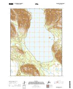
2019 Map of Dillingham A-8 NW
USGS Topo · Published 2019About this map
Lake Nunavaugaluk dominates this portion of the Dillingham Census Area, filling a glacial valley between the eastern flanks of the Wood River Mountains. This 2019 survey documents the hydrologic interface where the lake feeds the Snake River, which winds through the lowlands in the southern reach of the quadrangle. The landscape is characterized by high-elevation ridges to the west and east that descend into the central basin of the lake. While primarily a wilderness map, the inclusion of Snake Lake Road in the southeast corner indicates the reach of the local transportation network toward the water from nearby settlements. The map provides a clear record of the area's natural drainage patterns and the physical boundaries between township ranges including t11s r57w and t12s r57w.
Find a feature on this map
8 named features on this map. Tap any name to fly to it.
Don’t see what you’re looking for? This feature index may not catch every label — zoom into the map to look around manually.
Map Details
Editions of this 2019 Dillingham A-8 NW Map
This is the sole edition of this map. No revisions or reprints were ever made.
Other maps of this area

1951 · Dillingham
USGS Topo · 1:250,000

1951 · Goodnews
USGS Topo · 1:250,000

1952 · Dillingham A-8
USGS Topo · 1:63,360

1954 · Dillingham
USGS Topo · 1:250,000

1954 · Dillingham B-8
USGS Topo · 1:63,360
1979 · Goodnews Bay A-1
USGS Topo · 1:63,360

1979 · Goodnews Bay B-1
USGS Topo · 1:63,360

1979 · Goodnews Bay
USGS Topo · 1:250,000
2019 · Dillingham A-8 NE
USGS Topo · 1:25,000
2019 · Dillingham B-8 SE
USGS Topo · 1:25,000