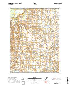
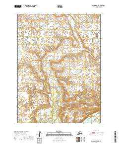
2019 Map of Dillingham B-3 NW
USGS Topo · Published 2019About this map
Glacial landforms and an intricate network of small wetlands define this remote landscape in the Dillingham Census Area. This 2019 survey, based on imagery from the U.S. Geological Survey and earlier hydrography data, depicts a region largely untouched by modern road infrastructure or named settlements. The terrain is organized by the Public Land Survey System grid, spanning portions of T8s R46w, T8s R45w, T9s R46w, and T9s R47w. The mapping of these townships reveals a dense concentration of unnamed water bodies and subtle contour variations, typical of the low-lying interior wilderness near the Bristol Bay region of Alaska.
Find a feature on this map
4 named features on this map. Tap any name to fly to it.
Don’t see what you’re looking for? This feature index may not catch every label — zoom into the map to look around manually.
Map Details
Editions of this 2019 Dillingham B-3 NW Map
This is the sole edition of this map. No revisions or reprints were ever made.
Other maps of this area

1951 · Dillingham
USGS Topo · 1:250,000

1954 · Dillingham
USGS Topo · 1:250,000

1954 · Dillingham B-4
USGS Topo · 1:63,360

1954 · Dillingham C-3
USGS Topo · 1:63,360

1954 · Dillingham B-3
USGS Topo · 1:63,360

1954 · Dillingham C-4
USGS Topo · 1:63,360
2019 · Dillingham C-3 SE
USGS Topo · 1:25,000
2019 · Dillingham B-4 NE
USGS Topo · 1:25,000
2019 · Dillingham B-3 SW
USGS Topo · 1:25,000
2019 · Dillingham C-4 SE
USGS Topo · 1:25,000