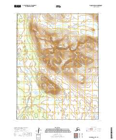
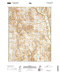
2019 Map of Dillingham B-7 SE
USGS Topo · Published 2019About this map
The Muklung Hills dominate the topography of this Dillingham landscape, rising steeply from the coastal lowlands of southwestern Alaska. The terrain is defined by a dense network of watercourses, including the Iowithla River which snakes across the northern sections, while the Muklung River and Little Muklung River drain the southern slopes. This 2019 survey shows the area's natural state, characterized by significant elevation changes that peak within the central hills before descending toward the tidal reach of Mud Bay. The map provides a detailed view of the complex hydrography and undeveloped terrain typical of the Dillingham Census Area, where land use is primarily governed by natural water drainage patterns rather than human infrastructure or road networks.
Find a feature on this map
11 named features on this map. Tap any name to fly to it.
Don’t see what you’re looking for? This feature index may not catch every label — zoom into the map to look around manually.
Map Details
Editions of this 2019 Dillingham B-7 SE Map
This is the sole edition of this map. No revisions or reprints were ever made.
Other maps of this area

1951 · Dillingham
USGS Topo · 1:250,000

1952 · Dillingham A-6
USGS Topo · 1:63,360

1952 · Dillingham A-7
USGS Topo · 1:63,360

1954 · Dillingham
USGS Topo · 1:250,000

1954 · Dillingham B-7
USGS Topo · 1:63,360

1954 · Dillingham B-6
USGS Topo · 1:63,360
2019 · Dillingham B-6 SW
USGS Topo · 1:25,000
2019 · Dillingham A-7 NE
USGS Topo · 1:25,000
2019 · Dillingham B-6 NW
USGS Topo · 1:25,000
2019 · Dillingham A-6 NW
USGS Topo · 1:25,000