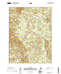
2019 Map of Dillingham C-7 NE
USGS Topo · Published 2019About this map
Kokwok River snakes through the center of this remote landscape in the Dillingham Census Area, defining a terrain dominated by water and wetlands. The river's winding path is joined by smaller tributaries, including Moose Cr in the northwest and Spider Cr to the south. This 2019 survey illustrates a vast network of unnamed lakes and ponds scattered across the lowlands, reflecting the complex hydrology of the Alaskan interior. The map is organized by the Public Land Survey System, showing portions of townships t5s r54w, t5s r53w, t6s r54w, and t6s r53w. Without roads or settlements, the focus remains entirely on the natural drainage patterns and the subtle elevation changes of the river valley.
Find a feature on this map
7 named features on this map. Tap any name to fly to it.
Don’t see what you’re looking for? This feature index may not catch every label — zoom into the map to look around manually.
Map Details
Editions of this 2019 Dillingham C-7 NE Map
This is the sole edition of this map. No revisions or reprints were ever made.
Other maps of this area

1951 · Dillingham
USGS Topo · 1:250,000

1954 · Dillingham
USGS Topo · 1:250,000

1954 · Dillingham C-6
USGS Topo · 1:63,360

1954 · Dillingham D-6
USGS Topo · 1:63,360

1954 · Dillingham D-7
USGS Topo · 1:63,360

1954 · Dillingham C-7
USGS Topo · 1:63,360

2019 · Dillingham C-6 SW
USGS Topo · 1:25,000
2019 · Dillingham C-7 SE
USGS Topo · 1:25,000
2019 · Dillingham D-6 SW
USGS Topo · 1:25,000
2019 · Dillingham C-7 SW
USGS Topo · 1:25,000