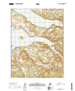
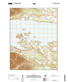
2019 Map of Dillingham C-7 SW
USGS Topo · Published 2019About this map
Lake Nerka and Lake Beverley dominate this remote Alaskan landscape, separated by a narrow land bridge where the Agulukpak River connects the two large water bodies. This 2019 survey captures the hydrological complexity of the Wood-Tikchik State Park region, where glacial lakes are fed by a network of smaller drainages including Mud Creek and Stovall Cr. The terrain is characterized by the sharp elevation changes between the lake surfaces and the surrounding ridges, with Stovall Lake sitting south of the primary lakes. Significant waterways like Beaver Cr wind through the southern portions of the quadrangle, illustrating the natural drainage patterns of the Dillingham Census Area. The map highlights the vast, uninhabited character of this lake system, emphasizing the importance of these waterways for travel and ecosystem connectivity in the Bristol Bay watershed.
Find a feature on this map
14 named features on this map. Tap any name to fly to it.
Don’t see what you’re looking for? This feature index may not catch every label — zoom into the map to look around manually.
Map Details
Editions of this 2019 Dillingham C-7 SW Map
This is the sole edition of this map. No revisions or reprints were ever made.
Other maps of this area

1951 · Dillingham
USGS Topo · 1:250,000

1954 · Dillingham
USGS Topo · 1:250,000

1954 · Dillingham B-7
USGS Topo · 1:63,360

1954 · Dillingham B-8
USGS Topo · 1:63,360

1954 · Dillingham C-7
USGS Topo · 1:63,360

1954 · Dillingham C-8
USGS Topo · 1:63,360
2019 · Dillingham C-7 SE
USGS Topo · 1:25,000
2019 · Dillingham B-7 NE
USGS Topo · 1:25,000
2019 · Dillingham B-7 NW
USGS Topo · 1:25,000
2019 · Dillingham C-8 SE
USGS Topo · 1:25,000