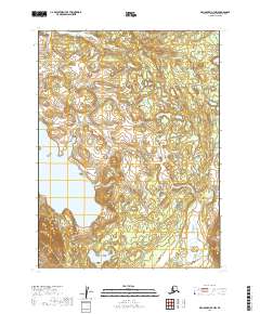
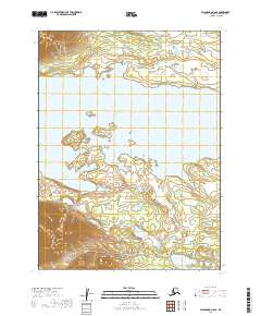
2019 Map of Dillingham B-7 NW
USGS Topo · Published 2019About this map
Lake Nerka dominates the southwestern corner of this landscape, its waters reaching into a terrain shaped by the intricate drainage of the Muklung River and smaller tributaries like Stovall Cr and Pike Cr. The map illustrates the complex hydrography typical of the Dillingham Census Area, where glacial-fed waters and lake systems define the travel and subsistence patterns of the region. This 2019 survey, drawing on imagery from 2016, provides a precise record of the shoreline and elevation contours before shifting environmental factors further alter these remote waterways. The absence of roads or permanent structures on this sheet underscores the preservation of the area's wild character, providing a baseline for studying the hydrology and land boundaries across the townships of T8S and T9S.
Find a feature on this map
9 named features on this map. Tap any name to fly to it.
Don’t see what you’re looking for? This feature index may not catch every label — zoom into the map to look around manually.
Map Details
Editions of this 2019 Dillingham B-7 NW Map
This is the sole edition of this map. No revisions or reprints were ever made.
Other maps of this area

1951 · Dillingham
USGS Topo · 1:250,000

1954 · Dillingham
USGS Topo · 1:250,000

1954 · Dillingham B-7
USGS Topo · 1:63,360

1954 · Dillingham B-8
USGS Topo · 1:63,360

1954 · Dillingham C-7
USGS Topo · 1:63,360

1954 · Dillingham C-8
USGS Topo · 1:63,360
2019 · Dillingham C-7 SE
USGS Topo · 1:25,000
2019 · Dillingham B-7 NE
USGS Topo · 1:25,000
2019 · Dillingham B-8 SE
USGS Topo · 1:25,000
2019 · Dillingham C-8 SE
USGS Topo · 1:25,000