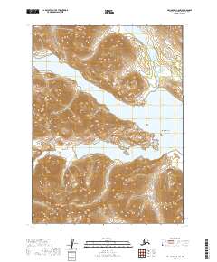
2019 Map of Dillingham C-8 NW
USGS Topo · Published 2019About this map
Mikchalk Lake and the northern reaches of Lake Beverley dominate this high-latitude terrain within the Wood-Tikchik area. The landscape is defined by the deep indentations of the Golden Horn and Silver Horn, which stretch between steep slopes. This 2019 survey documents a region of dramatic elevation changes, culminating at Akuluktok Peak in the southwest. The Peace River feeds into the northern waters, while Oimathluk Point marks a significant promontory along the eastern shore of Lake Beverley. The absence of roads or permanent settlements on this sheet highlights the wilderness character of the Dillingham Census Area, where the geography is dictated entirely by glacial lakes and the peaks that separate them.
Find a feature on this map
11 named features on this map. Tap any name to fly to it.
Don’t see what you’re looking for? This feature index may not catch every label — zoom into the map to look around manually.
Map Details
Editions of this 2019 Dillingham C-8 NW Map
This is the sole edition of this map. No revisions or reprints were ever made.
Other maps of this area

1951 · Dillingham
USGS Topo · 1:250,000

1951 · Goodnews
USGS Topo · 1:250,000

1954 · Dillingham
USGS Topo · 1:250,000

1954 · Dillingham D-8
USGS Topo · 1:63,360

1954 · Dillingham C-8
USGS Topo · 1:63,360

1979 · Goodnews Bay D-1
USGS Topo · 1:63,360

1979 · Goodnews Bay
USGS Topo · 1:250,000

1979 · Goodnews Bay C-1
USGS Topo · 1:63,360
2019 · Dillingham D-8 SW
USGS Topo · 1:25,000
2019 · Dillingham C-8 SW
USGS Topo · 1:25,000