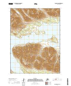
2019 Map of Dillingham C-8 SW
USGS Topo · Published 2019About this map
Lake Nerka dominates this landscape, where the waters of the Wood River system meet significant mountain ranges in southwest Alaska. To the north, the Wood River Mountains rise sharply from the shoreline, while the southern reaches of the quadrangle are defined by the Frog Mountains. The map reveals a complex aquatic geography including the protected waters of Ott Bay and several drainage systems such as Sam Cr, Joe Cr, and Ivan Cr. A prominent geographic feature, Elbow Point, juts into the lake, marking a sharp turn in the shoreline. This 2019 survey provides a contemporary view of this uninhabited wilderness, emphasizing the natural topography and hydrologic connections of the region before any significant human development.
Find a feature on this map
14 named features on this map. Tap any name to fly to it.
Don’t see what you’re looking for? This feature index may not catch every label — zoom into the map to look around manually.
Map Details
Editions of this 2019 Dillingham C-8 SW Map
This is the sole edition of this map. No revisions or reprints were ever made.
Other maps of this area

1951 · Dillingham
USGS Topo · 1:250,000

1951 · Goodnews
USGS Topo · 1:250,000

1954 · Dillingham
USGS Topo · 1:250,000

1954 · Dillingham B-8
USGS Topo · 1:63,360

1954 · Dillingham C-8
USGS Topo · 1:63,360

1979 · Goodnews Bay B-1
USGS Topo · 1:63,360

1979 · Goodnews Bay
USGS Topo · 1:250,000

1979 · Goodnews Bay C-1
USGS Topo · 1:63,360
2019 · Dillingham C-8 NW
USGS Topo · 1:25,000
2019 · Dillingham C-8 SE
USGS Topo · 1:25,000