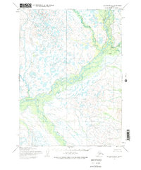
1954 Map of Dillingham D-2
USGS Topo · Published 1968About this map
Mulchatna River and the Koktuli River converge in this remote Alaskan wilderness, forming a complex network of braids and oxbows across the tundra. Recorded in the mid-1950s, the landscape shows very little human footprint, defined instead by the vast drainage systems of the Stuyahok River and Old Man Creek. The few markers of habitation are concentrated near the waterways, including a site of Ruins and scattered Cabins that indicate seasonal or subsistence use of the river corridors. The small settlement of Stuyahok sits near a prominent bend, serving as a rare anchor point in a territory otherwise dominated by seasonal tributaries like Pike Creek. This survey captures the region just as photogrammetric methods were beginning to document the intricacies of the state's interior water systems.
Find a feature on this map
9 named features on this map. Tap any name to fly to it.
Don’t see what you’re looking for? This feature index may not catch every label — zoom into the map to look around manually.
Map Details
Editions of this 1954 Dillingham D-2 Map
3 editions found
Other maps of this area

1950 · Taylor Mountains
USGS Topo · 1:250,000

1951 · Taylor Mountains
USGS Topo · 1:250,000

1951 · Dillingham
USGS Topo · 1:250,000

1954 · Taylor Mountains
USGS Topo · 1:250,000

1954 · Dillingham
USGS Topo · 1:250,000

1954 · Dillingham C-3
USGS Topo · 1:63,360

1954 · Dillingham D-2
USGS Topo · 1:63,360

1954 · Dillingham C-1
USGS Topo · 1:63,360

1954 · Dillingham D-3
USGS Topo · 1:63,360

1954 · Dillingham C-2
USGS Topo · 1:63,360