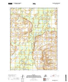
2019 Map of Dillingham D-4 NW
USGS Topo · Published 2019About this map
The Nushagak River dominates this landscape, winding through a complex network of wetlands and channels in the Dillingham area. This 2019 survey documents the fluid hydrology of the region, where the main river course is fed by smaller tributaries like Harris Cr. The map is primarily defined by its hydrographic features rather than human infrastructure, capturing the raw state of the Alaskan terrain as it existed in the late 2010s. The dense contour lines along the eastern margins reveal the transition from low-lying river plains to the more elevated interior highlands, providing a clear picture of the natural drainage patterns that have long influenced access and travel through this part of the Dillingham Census Area.
Find a feature on this map
6 named features on this map. Tap any name to fly to it.
Don’t see what you’re looking for? This feature index may not catch every label — zoom into the map to look around manually.
Map Details
Editions of this 2019 Dillingham D-4 NW Map
This is the sole edition of this map. No revisions or reprints were ever made.
Other maps of this area

1950 · Taylor Mountains
USGS Topo · 1:250,000

1951 · Taylor Mountains
USGS Topo · 1:250,000

1951 · Dillingham
USGS Topo · 1:250,000

1954 · Taylor Mountains
USGS Topo · 1:250,000

1954 · Dillingham
USGS Topo · 1:250,000
1954 · Dillingham D-5
USGS Topo · 1:63,360

1954 · Taylor Mountains A-4
USGS Topo · 1:63,360

1954 · Dillingham D-4
USGS Topo · 1:63,360

1954 · Taylor Mountains A-5
USGS Topo · 1:63,360
2019 · Dillingham D-4 NE
USGS Topo · 1:25,000