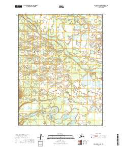
2019 Map of Dillingham D-5 NE
USGS Topo · Published 2019About this map
The Nuyakuk River meanders through this remote Alaskan landscape, defining the southern portion of the quadrangle with its wide, winding channel and numerous internal islands. Flowing toward the southwest, this major waterway is joined by the Pikehowik River, which cuts diagonally across the central terrain. The land is characterized by complex hydrology, showing an intricate network of small lakes and ponds typical of the Bristol Bay region's glacial legacy. Surveyed in 2019, the map captures a pristine wilderness devoid of roads or permanent settlements, structured primarily by the Public Land Survey System boundaries of t3s r48w and t3s r49w. For those studying the natural history of the Dillingham Census Area, this sheet provides a high-resolution look at the shifting riverbeds and wetland patterns that dominate the local ecosystem.
Find a feature on this map
6 named features on this map. Tap any name to fly to it.
Don’t see what you’re looking for? This feature index may not catch every label — zoom into the map to look around manually.
Map Details
Editions of this 2019 Dillingham D-5 NE Map
This is the sole edition of this map. No revisions or reprints were ever made.
Other maps of this area

1950 · Taylor Mountains
USGS Topo · 1:250,000

1951 · Taylor Mountains
USGS Topo · 1:250,000

1951 · Dillingham
USGS Topo · 1:250,000

1954 · Taylor Mountains
USGS Topo · 1:250,000

1954 · Dillingham
USGS Topo · 1:250,000
1954 · Dillingham D-5
USGS Topo · 1:63,360

1954 · Taylor Mountains A-4
USGS Topo · 1:63,360

1954 · Dillingham D-4
USGS Topo · 1:63,360

1954 · Taylor Mountains A-5
USGS Topo · 1:63,360
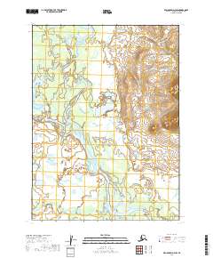
2019 · Dillingham D-4 SW
USGS Topo · 1:25,000