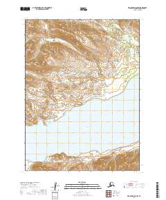
2019 Map of Dillingham D-8 NW
USGS Topo · Published 2019About this map
Nuyakuk Lake dominates the southern half of this landscape, its expansive waters meeting the rising elevation of the interior. To the northwest, the Red Hills provide a distinct topographical landmark, rising above the surrounding terrain in a series of defined ridges. The hydrology of the region is further defined by Ahguhlerok Cr., which flows through the northeastern portion of the survey. The mapping of these township and range boundaries, including t2s r56w and t3s r56w, reveals a wilderness area largely defined by its natural water bodies and elevation changes rather than human development. This 2019 survey captures the state of this remote Alaskan environment at a time when its primary features remained the massive lake systems and the surrounding hills.
Find a feature on this map
9 named features on this map. Tap any name to fly to it.
Don’t see what you’re looking for? This feature index may not catch every label — zoom into the map to look around manually.
Map Details
Editions of this 2019 Dillingham D-8 NW Map
This is the sole edition of this map. No revisions or reprints were ever made.
Other maps of this area

1950 · Bethel
USGS Topo · 1:250,000

1950 · Taylor Mountains
USGS Topo · 1:250,000

1951 · Taylor Mountains
USGS Topo · 1:250,000

1951 · Dillingham
USGS Topo · 1:250,000

1951 · Goodnews
USGS Topo · 1:250,000

1954 · Taylor Mountains
USGS Topo · 1:250,000

1954 · Dillingham
USGS Topo · 1:250,000

1954 · Taylor Mountains A-8
USGS Topo · 1:63,360

1954 · Dillingham D-8
USGS Topo · 1:63,360

1979 · Bethel A-1
USGS Topo · 1:63,360