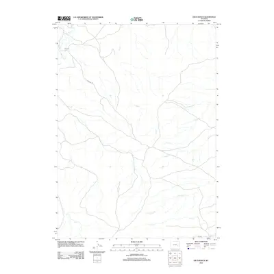
2012 Map of Dilts Ranch
USGS Topo · Published 2012About this map
Dilts Ranch sits near the headwaters of La Bonte Cr in a landscape defined by an intricate network of drainage systems. This 2012 survey of central Wyoming documents a corridor of significant historical transit, most notably the path of the Emigrant Trl as it cuts across the high terrain. The map tracks the winding courses of numerous water bodies, including Sand Cr, Spring Cr, and Trail Cr, which have long dictated the movement of livestock and travelers through this part of Converse County. The southern portion of the quadrangle is marked by N Elkhorn Cr and Coffee Cr, illustrating a rural landscape where modern ranching infrastructure follows established natural boundaries. The presence of Diltz Rd suggests the continued importance of these historical family-named landholdings in the 21st century.
Find a feature on this map
10 named features on this map. Tap any name to fly to it.
Don’t see what you’re looking for? This feature index may not catch every label — zoom into the map to look around manually.
Map Details
Editions of this 2012 Dilts Ranch Map
This is the sole edition of this map. No revisions or reprints were ever made.
Other maps of this area

1943 · Esterbrook
USGS Topo · 1:62,500

1945 · Esterbrook
USGS Topo · 1:62,500

1949 · Irvine
USGS Topo · 1:24,000

1949 · Poison Lake
USGS Topo · 1:24,000

1949 · Cedar Hill
USGS Topo · 1:24,000

1949 · Spring Creek
USGS Topo · 1:24,000

1949 · Dilts Ranch
USGS Topo · 1:24,000

1949 · Chalk Buttes
USGS Topo · 1:24,000

1949 · Orin
USGS Topo · 1:24,000

1950 · Spring Creek
USGS Topo · 1:24,000