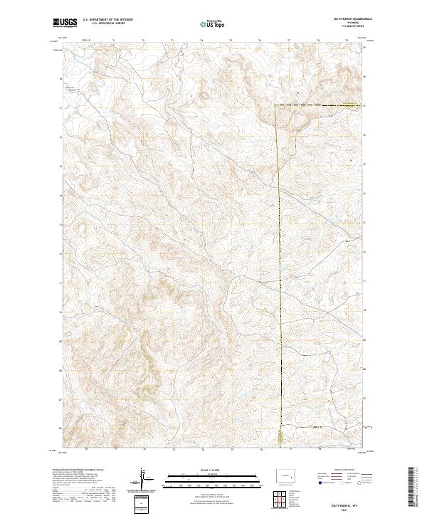
2021 Map of Dilts Ranch
USGS Topo · Published 2021About this map
Dilts Ranch serves as a primary landmark in this section of Converse County, Wyoming, situated along the historic Emigrant Trail. The landscape is defined by the drainage patterns of La Bonte Cr and Sand Creek, which carve through the high plains topography. This 2021 survey illustrates the modern persistence of traditional ranching boundaries and the sparse settlement patterns typical of this portion of the state. The map provides a clear view of the township and range system, showing how the land remains partitioned into large sections, a structure that has shaped local land use and ownership since the era of original homesteading.
Find a feature on this map
3 named features on this map. Tap any name to fly to it.
Don’t see what you’re looking for? This feature index may not catch every label — zoom into the map to look around manually.
Map Details
Editions of this 2021 Dilts Ranch Map
This is the sole edition of this map. No revisions or reprints were ever made.
Other maps of this area

1943 · Esterbrook
USGS Topo · 1:62,500

1945 · Esterbrook
USGS Topo · 1:62,500

1949 · Irvine
USGS Topo · 1:24,000

1949 · Poison Lake
USGS Topo · 1:24,000

1949 · Cedar Hill
USGS Topo · 1:24,000

1949 · Spring Creek
USGS Topo · 1:24,000

1949 · Dilts Ranch
USGS Topo · 1:24,000

1949 · Chalk Buttes
USGS Topo · 1:24,000

1949 · Orin
USGS Topo · 1:24,000

1950 · Spring Creek
USGS Topo · 1:24,000