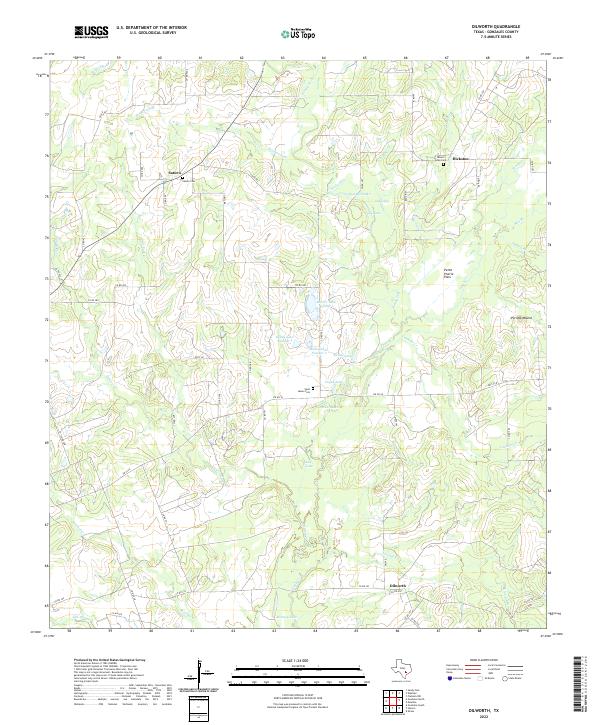
2022 Map of Dilworth
USGS Topo · Published 2022About this map
Saturn, Hickston, and Dilworth anchor this rural landscape in Gonzales County, characterized by a complex drainage system of creeks and small named lakes. The terrain is defined by the Sandy Fork and Peach Creek, which are fed by numerous tributaries such as Denton Creek, Vanham Creek, and Clear Fork Creek. For local history and genealogy, the map identifies several distinct burial grounds, including Saturn Cemetery, Mount Eden Cemetery, and Saint James Cemetery.
Find a feature on this map
64 named features on this map. Tap any name to fly to it.
Don’t see what you’re looking for? This feature index may not catch every label — zoom into the map to look around manually.
Map Details
Editions of this 2022 Dilworth Map
This is the sole edition of this map. No revisions or reprints were ever made.
Other maps of this area

1901 · Flatonia
USGS Topo · 1:125,000

1953 · Seguin
USGS Topo · 1:250,000

1958 · Seguin
USGS Topo · 1:250,000

1959 · Gonzales South
USGS Topo · 1:24,000

1959 · Hamon
USGS Topo · 1:24,000

1962 · Dilworth
USGS Topo · 1:24,000
1962 · Gonzales North
USGS Topo · 1:24,000
1964 · Sandy Fork
USGS Topo · 1:24,000

1964 · Waelder
USGS Topo · 1:24,000
1965 · Flatonia NW
USGS Topo · 1:24,000