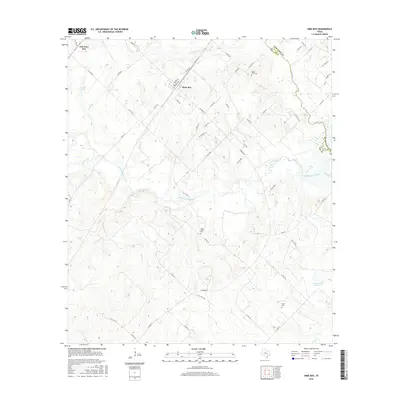
2016 Map of Dime Box
USGS Topo · Published 2016About this map
Dime Box and Old Dime Box anchor this landscape along the border of Lee and Burleson Counties. The map reveals the distinct separation between these two historic Texas communities, set amidst a complex network of waterways feeding into the Brazos River basin. Principal drainages like Middle Yegua Creek, W Yegua Cr, and Turkey Creek carve through the undulating terrain, defining the local topography and property boundaries. For those tracing family histories in this part of Texas, the map serves as a vital record of rural infrastructure, identifying long-standing landmarks such as Sandy Point Cem, High Prairie Cem, and Salem Cem. The presence of Smith Lake and Gerdes Lake Number 1 further illustrates the localized water management and land use patterns that have sustained these communities over generations.
Find a feature on this map
58 named features on this map. Tap any name to fly to it.
Don’t see what you’re looking for? This feature index may not catch every label — zoom into the map to look around manually.
Map Details
Editions of this 2016 Dime Box Map
This is the sole edition of this map. No revisions or reprints were ever made.
Other maps of this area

1919 · Giddings
USGS Topo · 1:62,500

1919 · Dime Box
USGS Topo · 1:62,500

1954 · Austin
USGS Topo · 1:250,000

1956 · Somerville
USGS Topo · 1:62,500

1958 · Ledbetter
USGS Topo · 1:24,000

1958 · Carmine
USGS Topo · 1:24,000
1958 · Giddings
USGS Topo · 1:24,000

1959 · Flag Pond
USGS Topo · 1:24,000
1959 · Dime Box
USGS Topo · 1:24,000
1960 · Tanglewood
USGS Topo · 1:24,000