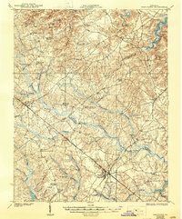
1919 Map of Disputanta
USGS Topo · Published 1944About this map
Waverly stands as a primary junction in the southeastern portion of this landscape, where the Norfolk and Western RR cuts a straight diagonal through the Tidewater terrain. This 1917 survey reveals a rural society structured around local gathering points, with the map recording a high density of neighborhood institutions like Zion Union Church, Chappell Hill School, and Sycamore School No 3. The convergence of Prince George, Surry, and Sussex counties occurs amidst a complex network of wetlands including Warwick Swamp, Otterdam Swamp, and Second Swamp.
Find a feature on this map
62 named features on this map. Tap any name to fly to it.
Don’t see what you’re looking for? This feature index may not catch every label — zoom into the map to look around manually.
Map Details
Editions of this 1919 Disputanta Map
3 editions found
Other maps of this area

1894 · Bermuda Hundred
USGS Topo · 1:62,500

1894 · Petersburg
USGS Topo · 1:62,500

1917 · Toano
USGS Topo · 1:62,500

1918 · Charles City
USGS Topo · 1:62,500

1918 · Toano
USGS Topo · 1:62,500

1919 · Jarratt
USGS Topo · 1:62,500

1919 · Surry
USGS Topo · 1:62,500

1919 · Disputanta
USGS Topo · 1:62,500

1919 · Homeville
USGS Topo · 1:48,000

1920 · Ivor
USGS Topo · 1:62,500