
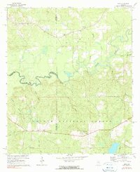
1971 Map of Dixie
USGS Topo · Published 1972About this map
Conecuh National Forest dominates the southern landscape of this 1971 survey, where the small community of Dixie and the settlement of Rome provide focal points for local history. The map documents a rural network of churches and family burial grounds, including the Mobley Creek Cem Ch, Feagin Cem, and Smith Cem, offering valuable data for genealogical research.
Find a feature on this map
30 named features on this map. Tap any name to fly to it.
Don’t see what you’re looking for? This feature index may not catch every label — zoom into the map to look around manually.
Map Details
Editions of this 1971 Dixie Map
3 editions found

Other maps of this area

1953 · Andalusia
USGS Topo · 1:250,000

1957 · Andalusia
USGS Topo · 1:250,000

1971 · Bradley
USGS Topo · 1:24,000

1971 · Carolina
USGS Topo · 1:24,000

1971 · Wing
USGS Topo · 1:24,000

1971 · River Falls
USGS Topo · 1:24,000

1971 · Loango
USGS Topo · 1:24,000

1982 · Damascus
USGS Topo · 1:24,000
1982 · Brooklyn
USGS Topo · 1:24,000
1982 · Parker Springs
USGS Topo · 1:24,000