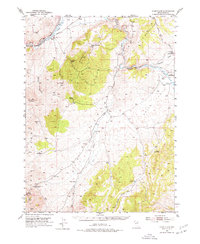
1952 Map of Dixie Flats
USGS Topo · Published 1977About this map
Bullion and the Site of Old Bullion lie at the base of the Pinon Range in this mid-century survey of the Nevada high desert. The map captures a complex intersection of historic western transit corridors where the Hastings Cut-Off, the California Trail, and the Elko Hamilton Stage Route converge near the Humboldt River. This geographic bottleneck forced early pioneers and later industrial infrastructure through narrow passages like the Tonka Tunnel and along the river banks.
Find a feature on this map
44 named features on this map. Tap any name to fly to it.
Don’t see what you’re looking for? This feature index may not catch every label — zoom into the map to look around manually.
Map Details
Editions of this 1952 Dixie Flats Map
4 editions found
Other maps of this area

1934 · Jiggs
USGS Topo · 1:125,000

1937 · Jiggs
USGS Topo · 1:125,000

1952 · Dixie Flats
USGS Topo · 1:62,500

1952 · Pine Valley
USGS Topo · 1:62,500

1952 · Carlin
USGS Topo · 1:62,500

1955 · Winnemucca
USGS Topo · 1:250,000

1955 · Elko
USGS Topo · 1:250,000

1956 · Robinson Mtn
USGS Topo · 1:62,500

1957 · Elko West
USGS Topo · 1:24,000

1957 · Elko East
USGS Topo · 1:24,000