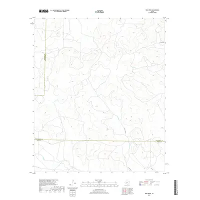
2019 Map of Dog Creek
USGS Topo · Published 2019About this map
The high plateau of West Texas dominates this 2019 survey, where the convergence of Tom Green, Sterling, and Irion Counties creates a landscape defined by seasonal drainages. Dry Rocky Cr and Dog Cr carve through the terrain, illustrating the hydrologic patterns of this arid region. The network of roads such as Funk Ranch Rd and Hall Ln suggests a landscape dedicated to large-scale ranching and land management, typical of the Edwards Plateau. These routes connect remote areas like Bates Rd and W Turner Rd to the broader regional infrastructure. The map reveals the intricate topography of numerous draws including Live Oak Cr and W Rocky Cr, providing a clear view of the drainage basins that define these county line boundaries.
Find a feature on this map
12 named features on this map. Tap any name to fly to it.
Don’t see what you’re looking for? This feature index may not catch every label — zoom into the map to look around manually.
Map Details
Editions of this 2019 Dog Creek Map
This is the sole edition of this map. No revisions or reprints were ever made.
Other maps of this area

1895 · Sherwood
USGS Topo · 1:125,000

1928 · Tankersly
USGS Topo · 1:62,500

1954 · San Angelo
USGS Topo · 1:250,000

1957 · Carlsbad
USGS Topo · 1:62,500

1957 · Knickerbocker
USGS Topo · 1:62,500

1958 · San Angelo
USGS Topo · 1:250,000

1965 · San Angelo
USGS Topo · 1:250,000

1972 · Arden
USGS Topo · 1:24,000

1972 · Dog Creek NE
USGS Topo · 1:24,000

1972 · Wallace Draw
USGS Topo · 1:24,000