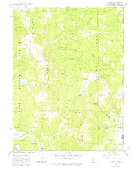
1981 Map of Dog Valley
USGS Topo · Published 1981About this map
Henness Pass Road cuts through the high country of the Bald Mountain Range and the Verdi Range, following a legendary trans-Sierra route that once served as a primary artery for mid-19th-century emigrants and freight. The 1981 landscape shown here is dominated by the shared terrain of the Tahoe National Forest and Toiyabe National Forest, where the state line divides Sierra County, California, from Washoe County, Nevada.
Find a feature on this map
35 named features on this map. Tap any name to fly to it.
Don’t see what you’re looking for? This feature index may not catch every label — zoom into the map to look around manually.
Map Details
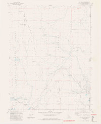
Editions of this 1981 Dog Valley Map
3 editions found

Other maps of this area

1890 · Sierraville
USGS Topo · 1:125,000

1891 · Carson
USGS Topo · 1:125,000

1891 · Truckee
USGS Topo · 1:125,000

1891 · Reno
USGS Topo · 1:125,000

1892 · Sierraville
USGS Topo · 1:125,000

1893 · Carson
USGS Topo · 1:125,000

1893 · Truckee
USGS Topo · 1:125,000

1893 · Reno
USGS Topo · 1:125,000

1894 · Sierraville
USGS Topo · 1:125,000

1895 · Truckee
USGS Topo · 1:125,000