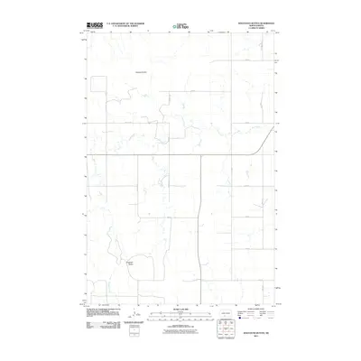
2011 Map of Dogtooth Buttes
USGS Topo · Published 2011About this map
Dogtooth Buttes rise above the high plains of southern Morton County, providing a distinct geographic focal point for this rural landscape. The area is defined by its intermittent drainage systems, notably Louse Creek and Dogtooth Creek, which cut through the agricultural sections in the early 21st century. The map reveals a strictly regulated grid of section roads, such as 64th St and 40th Ave, that delineate the vast farm and ranch land. In the northern portion of the quadrangle, Whiskey Buttes offers another prominent landmark within this sparsely populated prairie region. This survey captures a moment in the region's recent history where the infrastructure remains dedicated to large-scale land management and traditional North Dakota ranching.
Find a feature on this map
20 named features on this map. Tap any name to fly to it.
Don’t see what you’re looking for? This feature index may not catch every label — zoom into the map to look around manually.
Map Details
Editions of this 2011 Dogtooth Buttes Map
This is the sole edition of this map. No revisions or reprints were ever made.
Other maps of this area

1954 · Bismarck
USGS Topo · 1:250,000

1958 · Bismarck
USGS Topo · 1:250,000

1980 · Otter Creek West
USGS Topo · 1:24,000

1980 · Brisbane
USGS Topo · 1:24,000

1980 · Otter Creek East
USGS Topo · 1:24,000

1980 · Freda
USGS Topo · 1:24,000

1980 · Lark
USGS Topo · 1:24,000

1980 · Dogtooth Buttes
USGS Topo · 1:24,000

1980 · Raleigh
USGS Topo · 1:24,000

1980 · Nygren Dam
USGS Topo · 1:24,000