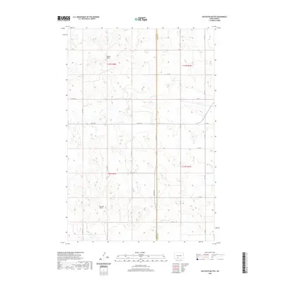
2020 Map of Dogtooth Buttes
USGS Topo · Published 2020About this map
Whiskey Buttes and Dogtooth Buttes anchor this portion of the Missouri Plateau, where the open prairie is defined by prominent landforms and a network of seasonal drainages. The landscape is bisected by the Grant and Morton County line, reflecting the formal township and range system that organized this agricultural region. Waterways such as Louse Cr and Dogtooth Cr wind through the sections, dictated by the elevation changes of the high plains. This survey documents the rural character of the area in the early twenty-first century, showing a sparse grid of section-line roads like 66th St SW and 71st St that connect isolated farmsteads. The lack of concentrated settlements highlights the enduring nature of North Dakota’s wide-open ranching and farming lands, where local movement still follows the historical paths established by early homesteaders and county planners.
Find a feature on this map
19 named features on this map. Tap any name to fly to it.
Don’t see what you’re looking for? This feature index may not catch every label — zoom into the map to look around manually.
Map Details
Editions of this 2020 Dogtooth Buttes Map
This is the sole edition of this map. No revisions or reprints were ever made.
Other maps of this area

1954 · Bismarck
USGS Topo · 1:250,000

1958 · Bismarck
USGS Topo · 1:250,000

1980 · Otter Creek West
USGS Topo · 1:24,000

1980 · Brisbane
USGS Topo · 1:24,000

1980 · Otter Creek East
USGS Topo · 1:24,000

1980 · Freda
USGS Topo · 1:24,000

1980 · Lark
USGS Topo · 1:24,000

1980 · Dogtooth Buttes
USGS Topo · 1:24,000

1980 · Raleigh
USGS Topo · 1:24,000

1980 · Nygren Dam
USGS Topo · 1:24,000