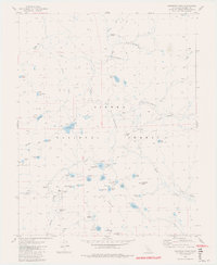
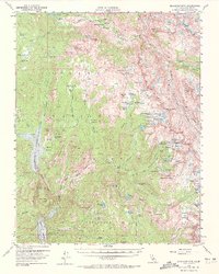
1982 Map of Dogtooth Peak
USGS Topo · Published 1982About this map
Sierra National Forest surrounds this high-elevation landscape, where 1970s photogrammetric mapping reveals a terrain defined by alpine meadows and glacial lakes. The western portion of the quadrangle is marked by Dinkey Creek and its associated chain of waters, including First Dinkey Lake, Second Dinkey Lake, and Island Lake. Evidence of localized industry persists near Eastern Brook Lake, where the Rainbow Mine and an adjacent Tailings Pond sit near the center of the survey area.
Find a feature on this map
61 named features on this map. Tap any name to fly to it.
Don’t see what you’re looking for? This feature index may not catch every label — zoom into the map to look around manually.
Map Details
Editions of this 1982 Dogtooth Peak Map
4 editions found
Other maps of this area

1904 · Kaiser
USGS Topo · 1:125,000

1912 · Mt. Goddard
USGS Topo · 1:125,000

1947 · Mariposa
USGS Topo · 1:250,000

1948 · Mariposa
USGS Topo · 1:250,000

1953 · Mt Abbot
USGS Topo · 1:62,500

1953 · Huntington Lake
USGS Topo · 1:62,500

1953 · Blackcap Mtn
USGS Topo · 1:62,500

1953 · Kaiser Peak
USGS Topo · 1:62,500

1957 · Mariposa
USGS Topo · 1:250,000
1962 · Blackcap Mtn
USGS Topo · 1:62,500