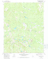
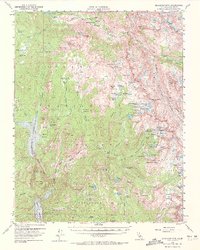
1982 Map of Dogtooth Peak
USGS Topo · Published 1988About this map
Sierra National Forest dominates this high-altitude landscape in Fresno County, defined by a dense network of alpine lakes and glacial basins. The area is anchored by the prominent Dogtooth Peak and the Three Sisters, where the terrain drops into the headwaters of Dinkey Creek and various forks of Big Creek. This early 1980s data highlights a rugged backcountry economy shifted from historic extraction toward recreation, evidenced by numerous named meadows such as Miningtown Meadow and Rockhouse Meadow. A series of interconnected water bodies, including First Dinkey Lake, Second Dinkey Lake, and Island Lake, occupy the granite basins below Foster Ridge. The mapping also identifies remote outposts like Qualls Camp and a system of 4WD trails that provided access to the high meadows and campsites during the post-war era of forest management.
Find a feature on this map
60 named features on this map. Tap any name to fly to it.
Don’t see what you’re looking for? This feature index may not catch every label — zoom into the map to look around manually.
Map Details
Editions of this 1982 Dogtooth Peak Map
4 editions found
Other maps of this area

1904 · Kaiser
USGS Topo · 1:125,000

1912 · Mt. Goddard
USGS Topo · 1:125,000

1947 · Mariposa
USGS Topo · 1:250,000

1948 · Mariposa
USGS Topo · 1:250,000

1953 · Mt Abbot
USGS Topo · 1:62,500

1953 · Huntington Lake
USGS Topo · 1:62,500

1953 · Blackcap Mtn
USGS Topo · 1:62,500

1953 · Kaiser Peak
USGS Topo · 1:62,500

1957 · Mariposa
USGS Topo · 1:250,000
1962 · Blackcap Mtn
USGS Topo · 1:62,500