
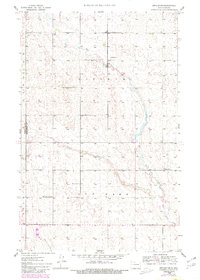
1948 Map of Dokken SW
USGS Topo · Published 1948About this map
East Cut Bank Creek and West Cut Bank Creek converge in this section of North Dakota, forming the main stem of Cut Bank Creek as it winds through the prairie. Surveyed in the late 1940s, the landscape is defined by the rural townships of Hoffman and Cutbank, where the grid of sections is punctuated by symbols of early community life. Small country schoolhouses like School No 1 and School No 2 are situated to serve the surrounding farmsteads. Genealogical interest is centered on the local burial grounds, including the Brotherhood Cem and the Mohall Cem, both located near the western boundary where the map meets the border between Renville and Bottineau counties. The terrain is characterized by the intricate drainage patterns of the creek system against the plateau of the northern plains.
Find a feature on this map
10 named features on this map. Tap any name to fly to it.
Don’t see what you’re looking for? This feature index may not catch every label — zoom into the map to look around manually.
Map Details
Editions of this 1948 Dokken SW Map
3 editions found
Other maps of this area

1948 · Mohall
USGS Topo · 1:24,000

1948 · Lansford
USGS Topo · 1:62,500

1949 · Lansford NW
USGS Topo · 1:24,000

1949 · Mohall NE
USGS Topo · 1:24,000

1949 · Lansford NE
USGS Topo · 1:24,000

1949 · Grano NE
USGS Topo · 1:24,000

1950 · Lansford
USGS Topo · 1:62,500

1950 · Antler NW
USGS Topo · 1:24,000

1950 · Mohall
USGS Topo · 1:62,500

1950 · Antler
USGS Topo · 1:24,000