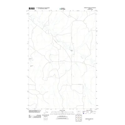
2011 Map of Dorothy Draw
USGS Topo · Published 2011About this map
Cabin Creek winds through the center of this eastern Montana landscape, anchoring a drainage system that includes McNaney Creek and Deer Creek. The terrain is defined by the significant geographic feature of Dorothy Draw, which sits at the intersection of a local road network. Infrastructure for water management and ranching is evident through landmarks such as Cabin Dam and Rattlesnake Dam.
Find a feature on this map
10 named features on this map. Tap any name to fly to it.
Don’t see what you’re looking for? This feature index may not catch every label — zoom into the map to look around manually.
Map Details
Editions of this 2011 Dorothy Draw Map
This is the sole edition of this map. No revisions or reprints were ever made.
Other maps of this area

1953 · Miles City
USGS Topo · 1:250,000

1957 · Miles City
USGS Topo · 1:250,000

1958 · Miles City
USGS Topo · 1:250,000

1981 · Mildred NE
USGS Topo · 1:24,000

1981 · Lawrence Creek West
USGS Topo · 1:24,000
1981 · Ismay North
USGS Topo · 1:24,000

1981 · Dorothy Draw
USGS Topo · 1:24,000

1981 · Ayer Spring NE
USGS Topo · 1:24,000

1981 · Ayer Spring
USGS Topo · 1:24,000

1981 · Wibaux
USGS Topo · 1:100,000