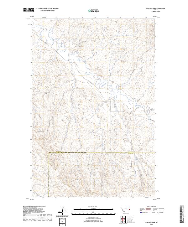
2024 Map of Dorothy Draw
USGS Topo · Published 2024About this map
McNaney Creek and Cabin Creek wind through this open Montana rangeland, where the topography is defined by the erosional patterns of Dorothy Draw and Lambing Draw. Situated along the border of Prairie and Fallon Counties, this area illustrates a sparse, ranching-oriented landscape. The network of unpaved tracks, including Cabin Creek Rd and Plevna Rd, follows the contours of the land rather than a rigid grid, suggesting a terrain where movement is dictated by natural drainage and ridge lines. The map provides a contemporary record of these intermittent watercourses and the survey townships of t11n r56e and t12n r56e, offering a clear view of the rural infrastructure in this portion of eastern Montana.
Find a feature on this map
16 named features on this map. Tap any name to fly to it.
Don’t see what you’re looking for? This feature index may not catch every label — zoom into the map to look around manually.
Map Details
Editions of this 2024 Dorothy Draw Map
This is the sole edition of this map. No revisions or reprints were ever made.
Other maps of this area

1953 · Miles City
USGS Topo · 1:250,000

1957 · Miles City
USGS Topo · 1:250,000

1958 · Miles City
USGS Topo · 1:250,000

1981 · Mildred NE
USGS Topo · 1:24,000

1981 · Lawrence Creek West
USGS Topo · 1:24,000
1981 · Ismay North
USGS Topo · 1:24,000

1981 · Dorothy Draw
USGS Topo · 1:24,000

1981 · Ayer Spring NE
USGS Topo · 1:24,000

1981 · Ayer Spring
USGS Topo · 1:24,000

1981 · Wibaux
USGS Topo · 1:100,000