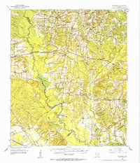
1952 Map of Douglass
USGS Topo · Published 1953About this map
The Old San Antonio Trail cuts across this East Texas landscape, following a historic corridor through Douglass and toward Linwood. The 1952 geography is defined by the winding course of the Angelina River and its complex network of tributaries like Monkey Creek and Beaver Creek, alongside the St Louis Southwestern railroad. This survey captures a rural social landscape in transition, where community hubs like Haney Chapel and Grange Hall Sch anchor local life alongside several sites already noted as out of use.
Find a feature on this map
51 named features on this map. Tap any name to fly to it.
Don’t see what you’re looking for? This feature index may not catch every label — zoom into the map to look around manually.
Map Details
Editions of this 1952 Douglass Map
2 editions found

Other maps of this area

1943 · Cushing
USGS Topo · 1:62,500

1943 · Rusk
USGS Topo · 1:62,500

1945 · Cushing
USGS Topo · 1:62,500

1945 · Rusk
USGS Topo · 1:62,500

1946 · Alto
USGS Topo · 1:62,500

1949 · Lufkin
USGS Topo · 1:62,500

1949 · Clawson
USGS Topo · 1:24,000

1950 · Clawson
USGS Topo · 1:24,000

1950 · Redland
USGS Topo · 1:24,000

1950 · Kennard NE
USGS Topo · 1:24,000