
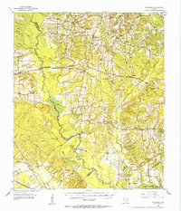
1952 Map of Douglass
USGS Topo · Published 1953About this map
The Old San Antonio Road serves as a primary east-west axis through this Deep East Texas landscape, passing through the historic settlement of Douglass. The mapping captures a period of transition in rural education and community structure, noting several decommissioned sites such as Eden Sch and Alazan Sch. These markers of past social centers are surrounded by numerous country houses of worship including Haney Chapel, Salem Church, and Isaiah Church.
Find a feature on this map
48 named features on this map. Tap any name to fly to it.
Don’t see what you’re looking for? This feature index may not catch every label — zoom into the map to look around manually.
Map Details
Editions of this 1952 Douglass Map
2 editions found
Other maps of this area

1943 · Cushing
USGS Topo · 1:62,500

1943 · Rusk
USGS Topo · 1:62,500

1945 · Cushing
USGS Topo · 1:62,500

1945 · Rusk
USGS Topo · 1:62,500

1946 · Alto
USGS Topo · 1:62,500

1949 · Lufkin
USGS Topo · 1:62,500

1949 · Clawson
USGS Topo · 1:24,000

1950 · Clawson
USGS Topo · 1:24,000

1950 · Redland
USGS Topo · 1:24,000

1950 · Kennard NE
USGS Topo · 1:24,000