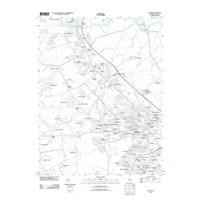
2011 Map of Dover
USGS Topo · Published 2011About this map
The Saint Jones River and the Leipsic River anchor the landscape of the Delaware state capital during this 2011 survey. The city core is surrounded by an intricate web of suburban developments and older pockets of settlement such as Bishops Corner, Cheswold Farms, and Carlisle Village. Significant local landmarks include the Dover Downs complex and Dover Mall, illustrating the commercial expansion of the era. To the north, the Delaware Airpark and Garrisons Lake provide distinct geographic markers near Bethel.
Find a feature on this map
140 named features on this map. Tap any name to fly to it.
Don’t see what you’re looking for? This feature index may not catch every label — zoom into the map to look around manually.
Map Details
Editions of this 2011 Dover Map
This is the sole edition of this map. No revisions or reprints were ever made.
Other maps of this area

1890 · Bay Side
USGS Topo · 1:62,500

1894 · Bay Side
USGS Topo · 1:62,500

1899 · Vineland
USGS Topo · 1:125,000

1899 · Dover
USGS Topo · 1:125,000

1906 · Dover
USGS Topo · 1:125,000

1919 · Vineland
USGS Topo · 1:125,000

1920 · Dover
USGS Topo · 1:125,000

1926 · Wyoming
USGS Topo · 1:48,000

1930 · Wyoming
USGS Topo · 1:62,500

1931 · Wyoming
USGS Topo · 1:62,500