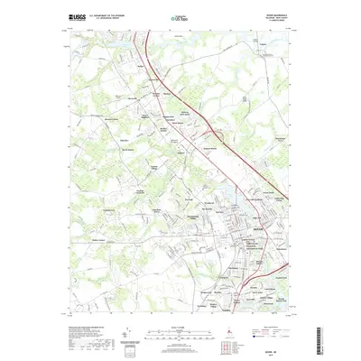
2019 Map of Dover
USGS Topo · Published 2019About this map
Silver Lake and the Saint Jones River anchor the heart of Delaware’s capital, where the city’s residential expansion meets the tidal wetlands of the Delmarva Peninsula. The map details a landscape transition from the established government center at Capitol Green to the burgeoning suburban developments of Bicentennial Village, Towne Point, and East Lake Gardens. This 2019 survey captures the modern footprint of the First State National Historical Park, reflecting the preservation of the state's earliest political history amid contemporary growth.
Find a feature on this map
263 named features on this map. Tap any name to fly to it.
Don’t see what you’re looking for? This feature index may not catch every label — zoom into the map to look around manually.
Map Details
Editions of this 2019 Dover Map
This is the sole edition of this map. No revisions or reprints were ever made.
Other maps of this area

1890 · Bay Side
USGS Topo · 1:62,500

1894 · Bay Side
USGS Topo · 1:62,500

1899 · Vineland
USGS Topo · 1:125,000

1899 · Dover
USGS Topo · 1:125,000

1906 · Dover
USGS Topo · 1:125,000

1919 · Vineland
USGS Topo · 1:125,000

1920 · Dover
USGS Topo · 1:125,000

1926 · Wyoming
USGS Topo · 1:48,000

1930 · Wyoming
USGS Topo · 1:62,500

1931 · Wyoming
USGS Topo · 1:62,500