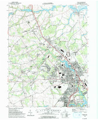
1993 Map of Dover
USGS Topo · Published 1993About this map
Dover stands as the primary hub of this 1993 study, showing the city's late-twentieth-century residential expansion and the complex water systems that frame it. The Leipsic River and its branches, including Muddy Branch and Fork Branch, weave through a landscape of evolving suburban developments like Chestnut Grove and Foxhall Meadows. This period captures the city's civic and commercial growth, documented through the presence of the Delaware Airpark, the Blue Hen Mall, and the Dover Downs Intl Speedway.
Find a feature on this map
113 named features on this map. Tap any name to fly to it.
Don’t see what you’re looking for? This feature index may not catch every label — zoom into the map to look around manually.
Map Details
Editions of this 1993 Dover Map
This is the sole edition of this map. No revisions or reprints were ever made.
Other maps of this area

1890 · Bay Side
USGS Topo · 1:62,500

1894 · Bay Side
USGS Topo · 1:62,500

1899 · Vineland
USGS Topo · 1:125,000

1899 · Dover
USGS Topo · 1:125,000

1906 · Dover
USGS Topo · 1:125,000

1919 · Vineland
USGS Topo · 1:125,000

1920 · Dover
USGS Topo · 1:125,000

1926 · Wyoming
USGS Topo · 1:48,000

1930 · Wyoming
USGS Topo · 1:62,500

1931 · Wyoming
USGS Topo · 1:62,500