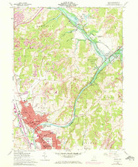
1961 Map of Dover
USGS Topo · Published 1972About this map
The Tuscarawas River valley serves as the central artery for this 1961 survey, where the expanding industrial and residential centers of Dover and New Philadelphia begin to converge. The landscape is a complex mix of heavy industry and civic infrastructure, evidenced by the County Fairground, Union Hospital, and numerous educational sites like Dover Avenue Sch. To the north, the river is controlled by the Dover Dam, creating a managed water system that includes the Zoar Wildlife Area and Zoar Lake.
Find a feature on this map
71 named features on this map. Tap any name to fly to it.
Don’t see what you’re looking for? This feature index may not catch every label — zoom into the map to look around manually.
Map Details
Editions of this 1961 Dover Map
3 editions found
Other maps of this area

1909 · Uhrichsville
USGS Topo · 1:62,500

1911 · Uhrichsville
USGS Topo · 1:62,500

1911 · Newcomerstown
USGS Topo · 1:62,500

1912 · Dover
USGS Topo · 1:62,500

1913 · Newcomerstown
USGS Topo · 1:62,500

1914 · Navarre
USGS Topo · 1:62,500

1943 · Newcomerstown
USGS Topo · 1:62,500

1944 · Navarre
USGS Topo · 1:62,500

1944 · Dover
USGS Topo · 1:62,500

1951 · Canton
USGS Topo · 1:250,000