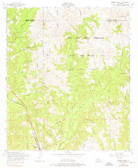
1954 Map of Dowden Creek
USGS Topo · Published 1976About this map
The Fort Polk Military Reservation dominates the center of this mid-century landscape, where federal land-use patterns began to reshape the rural character of Louisiana's Sabine and Vernon Parishes. Deep within the Artillery Range and across Peason Ridge, the terrain is marked by an extensive network of Dismantled railroads, tracing a former industrial footprint that once supported the region's timber economy. In the southwest corner, the settlement of Anacoco remains a focal point of civilian activity, situated along the Kansas City Southern railway line.
Find a feature on this map
29 named features on this map. Tap any name to fly to it.
Don’t see what you’re looking for? This feature index may not catch every label — zoom into the map to look around manually.
Map Details
Editions of this 1954 Dowden Creek Map
4 editions found
Other maps of this area

1941 · Leesville
USGS Topo · 1:62,500

1941 · Slagle
USGS Topo · 1:62,500

1942 · Florien
USGS Topo · 1:62,500

1942 · Kisatchie
USGS Topo · 1:62,500

1943 · Leesville
USGS Topo · 1:62,500

1943 · Kisatchie
USGS Topo · 1:62,500

1944 · Florien
USGS Topo · 1:62,500

1944 · Slagle
USGS Topo · 1:62,500

1946 · Leesville
USGS Topo · 1:62,500

1948 · Leesville
USGS Topo · 1:62,500