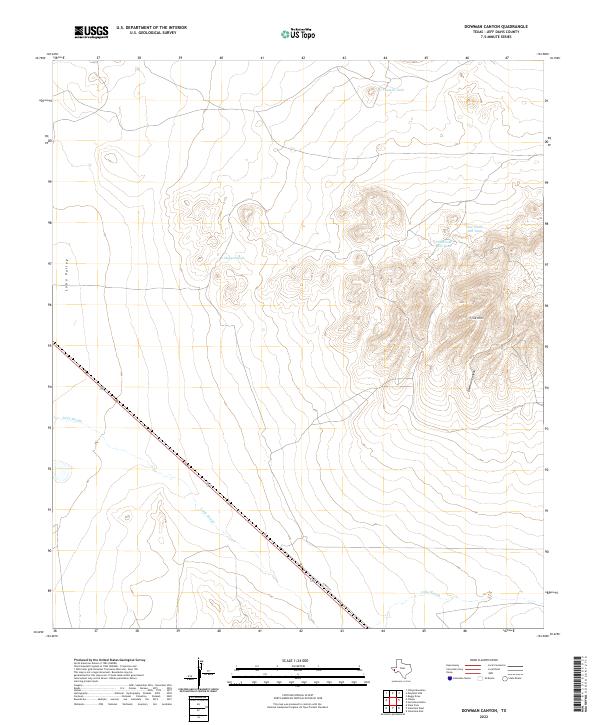
2022 Map of Dowman Canyon
USGS Topo · Published 2022About this map
Lobo Valley dominates the western portion of this Jeff Davis County landscape, where the flat basin floor meets the rising elevations of the Y-Six Hills. The terrain is defined by a network of drainage features and water catchments essential for ranching in this arid environment, including Dagger Tank and the neighboring Old Chalk Hill Tank and New Chalk Hill Tank. In the southeastern corner, the rugged topography of Dowman Canyon provides a sharp contrast to the valley floor. The path of Tally Slough meanders across the lower elevations, while N Main St serves as a primary transit corridor through the southern reaches. This modern survey reflects the enduring spatial organization of West Texas ranch lands, where named tanks and natural landforms remain the primary landmarks for navigation and land management.
Find a feature on this map
9 named features on this map. Tap any name to fly to it.
Don’t see what you’re looking for? This feature index may not catch every label — zoom into the map to look around manually.
Map Details
Editions of this 2022 Dowman Canyon Map
This is the sole edition of this map. No revisions or reprints were ever made.
Other maps of this area

1892 · Chispa
USGS Topo · 1:125,000

1894 · Valentine
USGS Topo · 1:125,000

1895 · Chispa
USGS Topo · 1:125,000

1897 · Valentine
USGS Topo · 1:125,000

1897 · Chispa
USGS Topo · 1:125,000

1943 · Valentine
USGS Topo · 1:125,000

1959 · Marfa
USGS Topo · 1:250,000

1965 · Marfa
USGS Topo · 1:250,000

1972 · Chispa
USGS Topo · 1:24,000
1972 · Chispa Mountain
USGS Topo · 1:24,000