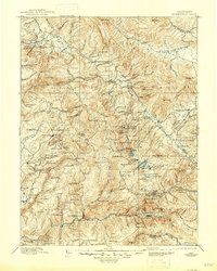
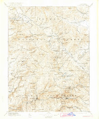
1897 Map of Downieville
USGS Topo · Published 1946About this map
Downieville and Quincy serve as the primary hubs in this late-19th-century survey of the northern Sierra Nevada, a region then defined by its intense mining activity. The landscape is a complex network of deep river canyons and high ridges, where the North Fork Yuba River and the Middle Fork Yuba River dominate the southern half of the sheet. Industrial history is etched into the terrain through numerous named workings, such as the Empire Mine, Young America Mine, and the Pliocene Mine near Cornish House.
Find a feature on this map
166 named features on this map. Tap any name to fly to it.
Don’t see what you’re looking for? This feature index may not catch every label — zoom into the map to look around manually.
Map Details
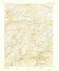
Editions of this 1897 Downieville Map
7 editions found

Other maps of this area

1886 · Honey Lake
USGS Topo · 1:250,000

1886 · Lassen Peak
USGS Topo · 1:250,000

1888 · Smartsville
USGS Topo · 1:125,000

1888 · Bidwell Bar
USGS Topo · 1:125,000

1890 · Sierraville
USGS Topo · 1:125,000

1891 · Bidwell Bar
USGS Topo · 1:125,000

1891 · Downieville
USGS Topo · 1:125,000

1891 · Honey Lake
USGS Topo · 1:250,000

1891 · Colfax
USGS Topo · 1:125,000

1891 · Truckee
USGS Topo · 1:125,000