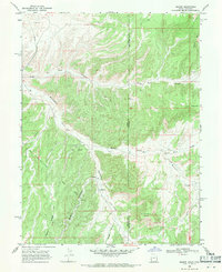
1968 Map of Dragon
USGS Topo · Published 1971About this map
The settlement of Dragon sits at the junction of Evacuation Creek and Dragon Canyon in this high-desert survey of the Utah-Colorado border. The landscape is defined by the extraction economy of the late 1960s, evidenced by the Evacuation Creek Gas Field and a series of Prospects and a Mine in the northern hills. The terrain is deeply incised, with Park Canyon and Atchee Canyon cutting through high plateaus that lead toward Park Mountain and Rabbit Mtn. A single Grave noted near the Industrial Waste Pond south of the Dragon townsite hints at the human cost and isolation of early industrial outposts in the Uinta Basin. Several Jeep Trails provide the only access across Rector Ridge and the surrounding draws, connecting the remote watercourses of Texas Creek and Missouri Creek to the larger drainage system.
Find a feature on this map
24 named features on this map. Tap any name to fly to it.
Don’t see what you’re looking for? This feature index may not catch every label — zoom into the map to look around manually.
Map Details
Editions of this 1968 Dragon Map
2 editions found
Other maps of this area

1885 · East Tavaputs
USGS Topo · 1:250,000

1956 · Grand Junction
USGS Topo · 1:250,000

1959 · Grand Junction
USGS Topo · 1:250,000

1960 · Grand Junction
USGS Topo · 1:250,000

1962 · Grand Junction
USGS Topo · 1:250,000

1964 · Grand Junction
USGS Topo · 1:250,000

1964 · Texas Creek
USGS Topo · 1:24,000

1964 · East Evacuation Creek
USGS Topo · 1:24,000
1964 · Banta Ridge
USGS Topo · 1:24,000

1965 · Grand Junction
USGS Topo · 1:250,000